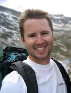
Tuesday, July 4, 2000 - Yosemite Valley
After our 27 hour bus ride from Vancouver we were exhausted and badly in need of a shower. We had some lunch in Yosemite Valley village, used the nearby showers and set off on the John Muir Trail (JMT) around 3PM.

DAY 1 - The bright blue sky and the incredible beauty of Yosemite motivated our tired bodies up the steep ascent out of the valley amongst the throng of dayhikers. An abundance of horse manure on the trail had us holding our breath while climbing the canyon...not nice! But the views of the valley and waterfalls got more and more rewarding as we climbed. Shortly after a late afternoon snack above Nevada Falls and a visit with the local park ranger we ran into our first (and ONLY) bear!

Some other hikers were cooking dinner and the very brave bear was just hanging out in the middle of the trail between myself and the other hikers. They were throwing rocks at it but it didn't seem to mind, until it noticed me standing on the trail behind it and bolted off into the trees. It didn't go very far before it turned around to watch me slowly walk up the trail pounding two rocks together noisily. Christy was a couple of minutes behind me, so I waited with the dinner-cooking hikers and warned her of the bear lurking in the woods to her left.
We tried to hike as far as we could to put distance between us and the bear, but it got dark within an hour of our bear encounter (maybe 2 miles) so we stealth camped right beside a huge boulder a few hundred metres away from some other camped hikers. After a quick, cold dinner away from our tent, we crawled into bed very tired from a long day of traveling and hiking...but we wouldn't get any sleep yet!
Shortly after dark the sound of banging pots and yelling from the campers below alerted us to the return of the bear! (I am assuming it was the same bear from earlier that evening but I can't be sure.) At least an hour went by with no sign of the bear and our stealth camp was looking very good when suddenly the dark silhouette of the bear silently passed just a few feet away from our tent! The bear didn't smell us and in fact, didn't even seem to take notice of us just a few feet away, and just kept walking away into the night and out of our lives...but not out of my mind! It was very hard to get a good sleep that night!
DAY 2 - We slept in late after being up late on our bear-watch and didn't get started on the trail until around 11:30 AM. We hiked about 9.5 miles today with a long lazy lunch break at Sunrise Camp. It was much cooler and windier today.

Lots of elevation gain today including an out-of-breath climb around 2 PM getting us above 10,000 feet. Beautiful alpine meadows meant a few mosquitos too. We camped high up (I think above 10,000 feet) on a ridge with an incredible panorama view as the sun set into the purple sky. Christy found the elevation gave her a fitful sleep (due to sleep apnoea) but at least no bears!
DAY 3 - 7.5 miles downhill into Tuolumne Meadows by 11:30 AM. Our first stop was the camp store and grill: burger, hot dog, Coke, fresh fruit and Ben & Jerry's ice cream! We picked up our food package and set up camp in almost the exact same spot as I had 4 years earlier during my PCT trek. We took the rest of the day off and lazed around by the river. In the afternoon, we took the free shuttle to Tuolumne Lodge for showers, it's a long walk! Note: Showers were only open from 12-3:30 PM to hikers and cost $2.
DAY 4 - Big day today: 18 miles up and over 11,056 foot Donahue Pass and out of Yosemite National Park.

Easy first 9 miles of the day in Lyell Canyon. No mosquitos or bears, but some fresh scat and some howling coyotes. Nice lunch stop at Lyell Camp anticipating the big ascent up the pass after lunch.
Great climb! Beautiful scenery and very little snow made our climb a breeze.

We rock-hopped across a tricky creek crossing, lost the trail briefly over a few larger patches of snow and traversed one large snowfield near the top before we reached the incredible views at Donahue Pass; north into Yosemite and south towards Ansel Adams Wilderness.

The descent from the pass was long and tiring on weary feet but the alpine valley was lined with many nice meadows and lakes. We continued on down to Rush Creek trail where the 3 creek crossings were easy (no wet crossings). Then an exhausting 500 foot climb over our last mile of the day to camp at windy Island Pass (10,200 ft). Again we stealth camped; so no bears, and I slept like a baby after a long day but the altitude affected Christy's sleep again.
DAY 5 - Chilly morning with ice on our tent fly and on the puddles on the trail. We hiked up and down between several picturesque alpine lakes with Thousand Island Lake being the highlight of the bunch.

Half way through our day we decided to hike 1 mile down (nearly straight down!) to the River Trail in the canyon below the ridge on which the John Muir Trail was following. After a wet crossing of the San Joaquin River we headed off down the hot and dusty river trail towards Reds Meadows and a day off!
The mosquitos were out in full force but listening to my walkman kept me dancing down the trail. After about 14 miles, near Devil's Postpile, we caught the "free" shuttle bus down to the Mammoth ski area where we easily hitched a ride the rest of the way down into Mammoth Lakes town and Motel 6. We took a night off in what felt like luxury: hot showers, HBO, pizza delivery, big bed...ahhh! Life only feels this good after being on the trail. Trail Magic! Super sweet.
DAY 6 - Day off in Mammoth Lakes. Slept in and walked around town. Shopped at Vons where I talked to Jedi, who was planning a 7 day speed-hike of the entire John Muir Trail. Whew!
We lunched at Base Camp Cafe where we turned fast food into slow food before we hitched back up to the ski village and took the $5 bus back to Red's Meadows. The campground at Red's is a rip-off at $14 for car camping or hikers (although you can use the hot spring showers for free). So instead we saddled up our gear and hiked 3 miles to Red Cones where the mosquitos were thick but the sunset was amazing!

DAY 7 - We hiked a tedious 15 miles today along a high ridge above Cascade Valley; a hot, up and down, mosquito-infested, mule crap-laden trail. Thank god for our walkmans and the beautiful breeze at our lunch break. I might recommend the lower, less tedious Cascade Valley trail with the very pleasant Fish Creek hot springs as an alternate route.
We stopped for dinner at the picturesque Virginia Lake, where the mosquitos eased their attack long enough for us to enjoy a good dinner and a short nap. But then we continued on to camp for the night at Tully Hole where the mosquito-insanity reached its maximum during our hike. Any longer there and I'm sure I would have gone crazy. (How do you go to the bathroom with so many mosquitos around?!?)
DAY 8 - 14 miles to Lake Edison and ferry to Vermilion Valley Resort (VVR).

The morning of continued mosquito-madness was made ever more torturous by a hot climb to Silver Pass while wearing our jacket and pants as mosquito-armour. There was very little snow on Silver Pass and Silver Lake was bright blue in the gorgeous summer sun. Amazingly, the mosquitos disappeared past Silver Pass, making our descent to Mono Creek fast and peaceful.

We caught the 4:45 pm ferry at Lake Edison and 20 minutes later we were sipping our free beer at the friendly Vermilion Valley Resort.
DAY 9 - 0 miles. We decided to take a day off at the resort and adjust our hiking plans so that we could meet up with our friends in Las Vegas on time. This meant that we would miss several days of the JMT from Muir Pass to Crabtree Meadows, but since I had hiked that section of the trail a few years ago I wasn't really disappointed. We met several PCT thru-hikers at VVR, including Flatfoot, aka Gene the hiking machine, who was hiking the PCT for the Sunshine Foundation charity. We also ran into Dan and Sara Rufner from San Diego, whom I had hiked with on the PCT in 1996! Small world. We sat and talked over dinner and planned to meet up again in a few days in Bishop.

DAY 10 - Back on the trail. Another hot, sunny day of hiking in the California Sierras, but very few mosquitos today made for a much more enjoyable walk. We camped near the Muir Trail Ranch and nearby hot springs, but we were so exhausted after a long day that we never even went in the hot springs.
DAY 11 - Another long day up and over Piute Pass on our way out to North Lake and beyond to Bishop. The morning began very nice with gorgeous hiking weather and beautiful scenery hiking up the Piute Creek canyon. But in the late afternoon, the mosquitos showed up again in large numbers and our long, gradual ascent of Piute Pass became torture. Thankfully once we reached the pass, the mosquitos had subsided and we camped just a mile or so beyond the pass beside one of several small crystal-clear alpine lakes.
DAY 12 - We hiked the last few miles steeply down from Piute Pass past many day-hikers from North Lake where we hitched a ride 18 miles into Bishop. Motel Rancho Relaxo, a huge dinner and some cold beer made for a great evening in Bishop.
DAY 13 - We met again with Dan and Sara for breakfast. They had completed there Sierra trek and were headed back home so we caught a ride with them to Lone Pine where we would get our Whitney climbing permits and finish our trek.
DAYS 14-16
We obtained a Whitney Mountaineers' Climbing Permit at the Ranger Station in Lone Pine, spent one night in town and set off to summit the tallest mountain in the lower 48 states, Mt. Whitney, at 14,494 feet.

The rangers provided us with details and information on the route and advised us that no technical equipment would be necessary to reach the top. The trail is a basic one-day hike with some minor scrambling up to the high camp at Iceberg Lake (see map below). From this point, the mountaineers' route heads straight up a snow-filled gully with some serious scrambling on steep terrain, to reach a saddle on the north side of the Whitney ridge. From there the grade levels out as the route winds around the more gently sloped west side of the mountain towards the summit.

Unfortunately, a large icy snowfield lies between the saddle and the summit and was a little dangerous to negotiate without an ice axe or crampons, wearing only approach shoes. Therefore, our summit attempt fell about 400 feet short of the top, but the views from the ridge were still very spectacular!
Mount Whitney Mountaineers' Route:


For comprehensive trail information, check out http://www.pcta.org/about_trail/muir/over.asp